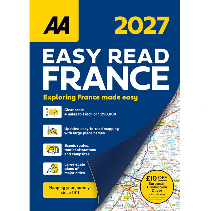
Discover your perfect travel partner for navigating France with ease. The AA Easy Read Atlas France is a large-scale, easy-to-read road atlas designed specifically for British motorists. Featuring clear 1:250,000 mapping, it simplifies every journey. Between A4 and A3 in size, this mid-sized, spiral-bound atlas is both convenient to handle and easy to use.
What’s Inside:
-
Full coverage of mainland France and Corsica
No destination is out of reach with comprehensive mapping.
-
Channel Tunnel details
Includes terminal plans for Folkestone and Calais, ensuring a smooth start to your trip.
-
Explore top French cities
Features a 2-page map of central Paris and super-scale detailed city plans for Bordeaux, Lille, Lyon, Marseille, Nice, Strasbourg, and Toulouse.
-
At-a-glance route overview
Quickly plan your journey with a clear view of all major roads and connections.
-
Essential travel rules and driving information
Covers France, Monaco, and Andorra, helping you drive with confidence.
-
Scenic and tourist routes
Highlights toll and toll-free motorways, scenic routes, and key attractions to help you make the most of your trip.
-
Added convenience
Features campsites, petrol stations, golf courses, ferries, and must-see places across the country.
-
Safety-focused information
Includes notes on steep gradients, winter closures, and routes unsuitable for caravans, allowing you to choose the safest and best routes.
Produced by expert European cartographers MairDumont, this atlas delivers exceptional clarity and detail—perfect for every drive, holiday, or adventure across France.